
Each campus of the University presented unique challenges for the implementation of the WiFi access points and technology. The project team had to assess each installation based on the best WiFi coverage maps and physical placement of the WiFi infrastructure.
The Google campus maps are continously updated with new WiFi access points - please see the short URLs below for each campus.
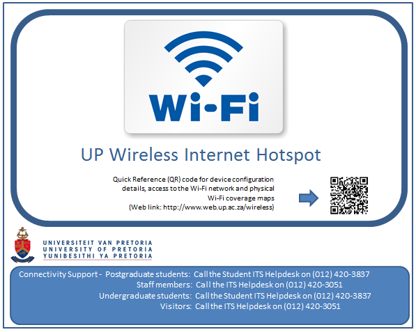
You can also look for the official WiFi signage indoors or outside buildings, which indicate WiFi coverage for the specific area on the campus grounds. The official UP wireless network signage looks like this (reduced in size for demonstration purposes):
UP WiFi areas are now visible on the Google maps of the various campuses, click on the campus link below and then type 'UP WiFi" in the search panel of Google Maps. All the available WiFi hot spot areas will be displayed for that specific campus:
- Hatfield Campus = "University of Pretoria Hatfield Campus"
- LC de Villiers Sports Campus/High Performance Centre = "University of Pretoria LC de Villiers Sports Campus/High Performance Centre"
- Groenkloof Campus = "University of Pretoria Groenkloof Campus"
- Prinshof Campus (Faculty of Health Science) = "University of Pretoria Faculty of Health Science"
- Onderstepoort Campus (Faculty of Veterinary Science) = "University of Pretoria Faculty of Veterinary Science"
- Mamelodi Campus = "University of Pretoria Mamelodi Campus"
Copyright © University of Pretoria 2024. All rights reserved.
COVID-19 Corona Virus South African Resource Portal
To contact the University during the COVID-19 lockdown, please send an email to [email protected]
 Virtual Campus
Get Social With Us
Download the UP Mobile App